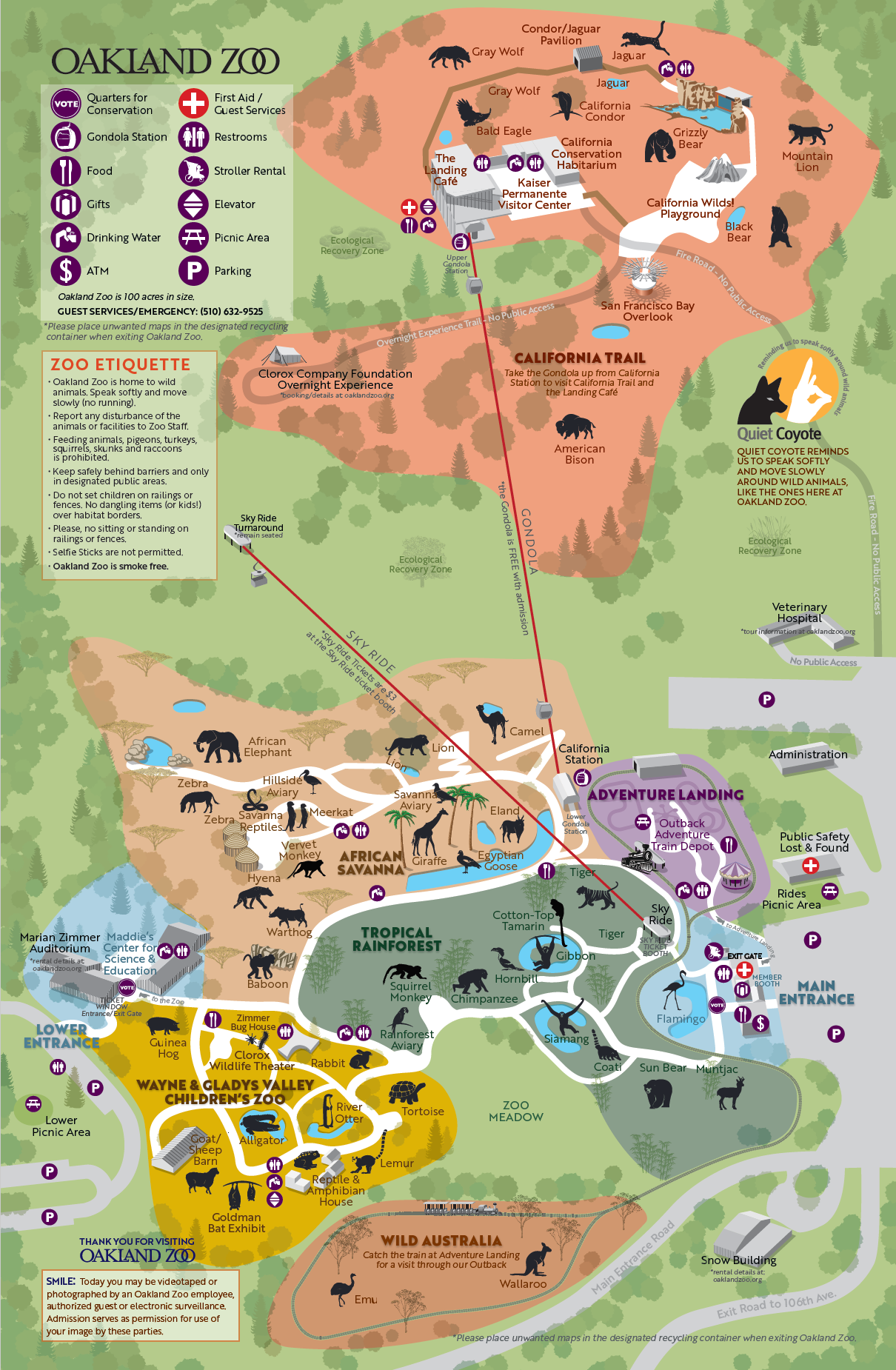
Oakland Zoo Visitor Map
Client: Conservation Society of California
Software: Adobe Illustrator, Adobe InDesign
In March 2018, I was asked by the Oakland Zoo to submit a proposal for a new visitor map.
Established in 1922, the Oakland Zoo has become a model of how to house wild animals from around the world so that they may be viewed by visitors in a close simulation of their natural habitat. The animals are not simply kept in cages, but allowed to roam in large enclosures.
The zoo is divided into several habitat sections – African Savanna, Tropical Rain Forest, Wild Australia, Adventure Landing (kids’ carnival rides), and the Wayne & Gladys Valley Children’s Zoo.
Originally occupying 43 acres on the western side of 490-acre Knowland Park, the zoo recently added 56 acres of new habitat for the California Trail exhibit. This new area is now home to many wild animals native to California, including eagles, California condors, mountain lions, black bears, grizzly bears, and wolves.
Because the new section is located up a steep slope, it is accessible to visitors only by riding an aerial gondola to the visitor center at the top of the hill. Perhaps worth the price of admission by itself, the center includes a new restaurant, a conservation habitarium, a children’s playground, and stunning views looking out across the San Francisco Bay.
With such a variety of habitat and terrain, the zoo needed a new visitor map that clearly showed the location of all the exhibits, without being overly complex and confusing, so visitors could easily find their way through the park. The habitat areas, typography, and even vegetation were color-coded to assist navigation.
The new map was released in time for the opening of the California Trail exhibit in summer, 2018.

